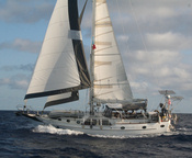
Cruising with Soggy Paws
Soggy Paws is a 44' CSY Sailboat, and has recently set sail on a 10 year around the world cruise.

Monday, March 03, 2008
Safe in Providencia
We just anchored after 36 hours enroute. Safe and sound.
Labels: OffshoreHondurastoPanama, On Passage
3 Comments:
Pictures and text copyright 2008 Sherry Beckett.
The Blog Template is generated via PsycHo and is Licensed.
The Blog Template is generated via PsycHo and is Licensed.
Dave
Pegasus III
http://www.saltysailors.com/Cruising%20Grounds/Mexico.htm
Look for 'NW Caribbean Charts Ebook'
I am trying to post the significant waypoints south of there.
Also, get the updated guidebooks by Freya Rauscher and Steve Pavladis.
When I get a wp from any source I first plot it on Google Earth to see if it is sensable and then plot it on a paper chart. Oops, I was about to bore you with my system for maintaining wp.
THanks again
Dave